Today we spent the day at Volcano National Park on the shoulders of Mauna Loa. Mauna Loa is absolutely the most massive mountain on the planet. If you measure from its base at the floor of the seabed, Mauna Loa rises 56,000 feet from the bottom which is over 27,000 feet higher than Mount Everest. The park gives you some idea of the forces at work here on the island and is an area of still intense volcanic activity. Caution is advised as one never really knows when a new flow could start or a new fissure could open up.
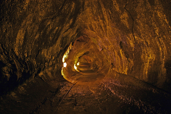
We got to the park early and took the crater rim drive clockwise so that we could first visit the Thurston lava tube that was formed about 400 years ago after the collapse of a pit crater adjacent to Kilauea Iki. Lava flowed through this tube until the eruption ceased when all the lava drained out of the tube leaving a 1400 foot long tube that can be explored by visitors. The trick is to get there early as it is a popular tourist spot for the tour busses that pull up and disgorge dozens to hundreds of people. When you arrive at the lava tube, you are rewarded with a beautiful fern rain forest surrounding the opening. Walking down the (usually) wet pathway, you are greeted by a lit 400 foot long walk through the lava tube. This path ends at a gate where you can continue on about 1000 feet more provided you bring your own light source or two because the Park Service does not light the entire length. I have to say that lava can have the most amazingly low albedo. Even with a tremendously bright flashlight, the eye just seems to roll right off the edges of the walls with no real ability to define borders. And for a real claustrophobia inducing experience, when you get to the back of the lava tube, turn off your light. Oh, man….. it’s blaaaaaaaaaack. About the only thing creepier that I’ve done is turn off my dive lights on a night dive off San Clemente island.
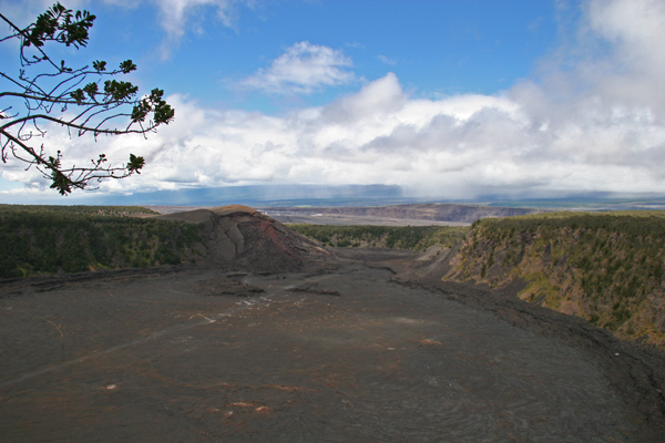
Walking across the road from the lava tube, you can take a four or five mile hike down through the rain forest down the side of the Kilauea Iki crater to the floor that was back in 1959, a lake of molten rock and fire. The lava fountain plume that came out of the crater erupted up to 1900 feet in the air setting a record for volcanic plumes in the Hawaiian islands giving you some idea for how impressive the forces are that created these islands.
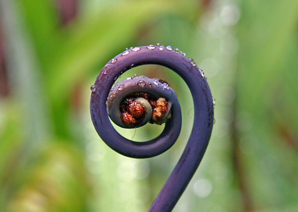
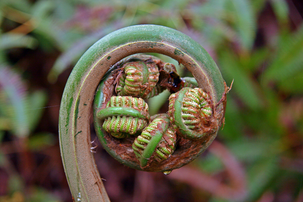
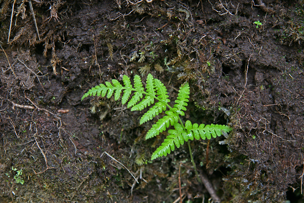
The hike down the side of the crater is like a trip back in time when ferns dominated the planet. I’ve always loved ferns and have been fascinated with their form, biology and evolution like the Hapu’u or Cibotium glaucum. In a way, moving from one microclimate to another through the park and down into the craters is like traveling in time from the Jurassic back to the Triassic and into early Earth history upon reaching the floor of the crater.
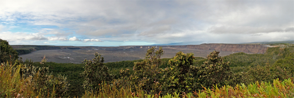
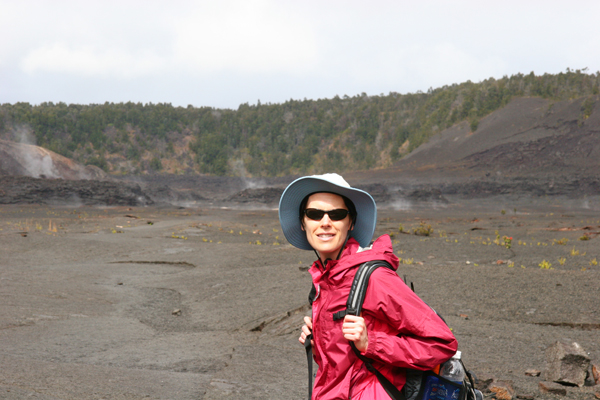
Upon reaching the end of the trail down the side of the crater wall, the path opens up to a view of the floor of Kilauea Iki. This vista shows a black, still steaming crater floor surrounded by verdant green walls. The path leading across the floor of the crater was an other worldly experience that any fan of J.R.R. Tolkien would recognize as you journey across the black crunchy lava as a path to Mordor.
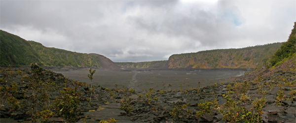
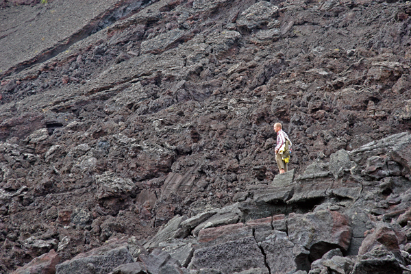
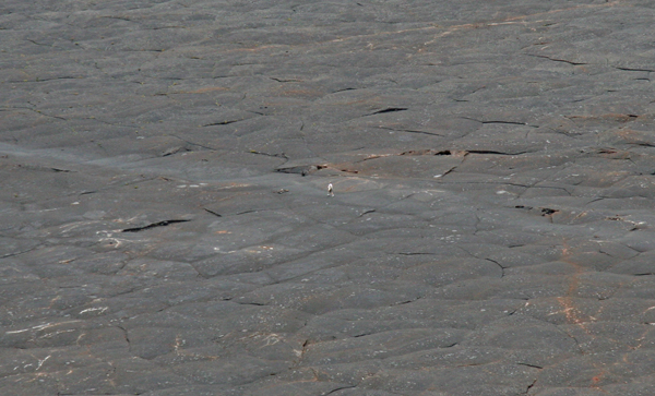
It is a desolate trip that initially one perceives as a monochrome environment, but upon closer inspection you see an amazing variety of blacks, grays, browns and rust colors in the lava. Even more impressive is the appearance that even pedestrian subjects take on when viewed against the background. Every object such as leaves, seeds or people walking across the lava become dramatic contrasts inserted into an otherworldly scene that is just the slightest bit incongruous.
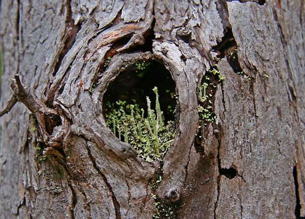
The trail continues directly across the crater floor until it reaches the far side that appears to have a bit more activity reflected by steam vents exuding fumes, salt and mineral deposits on the black lava along with a few more plants that appear to be taking opportunity by growing in cracks that provide shelter.
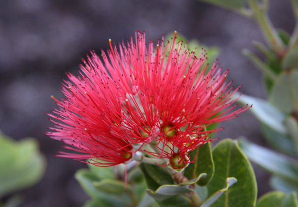
Punctuated in various spots across the lava fields can be found brilliant red blossoms on twisted and gnarled shrubs. The Lehua blossom has a legend associated with it that relates the story of a ancient chief named ‘Ohi’a. The goddess of the volcano, Pele was jealous of a beautiful girl, Lehua that ‘Ohi’a was courting as she wanted ‘Ohi’a for herself. So, one day Pele appeared to ‘Ohi’a in a most striking and beautiful form to ask ‘Ohi’a to be her husband. ‘Ohi’a politely turned her down and professed his love for Lehua. Pele was enraged and turned ‘Ohi’a into a twisted, grey tree that grows on lava fields. The other gods were upset at Pele’s behavior and tried to turn ‘Ohi’a back into human form, but failed in their attempts. So, to reunite the two, the gods turned Lehua into a beautiful red flower on the same tree. Today, it is said that to pick a Lehua blossom tempts fate and one runs the risk of losing your love.
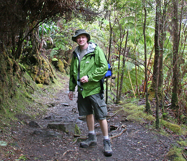
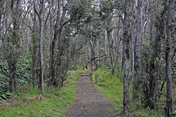
Climbing out of the crater, you ascend through this time through another microclimate, a hardwood forest with a trail that would, if mountain bikes were allowed, make one of the coolest single tracks in the world. This side of the crater is just a little drier than the side we descended through which has fewer ferns, more lichens and taller trees with Hawaiian honeycreepers singing and flying through the tops.
The trail continues along the rim of Kiauea Iki providing many vista points of the crater floor giving you some idea of what it must have looked like three decades or so ago when it was a lake of fire and molten rock with lava fountains shooting out of Kilauea Iki from 1,000 to 1,900 feet in the air which set a historical record for eruptions in Hawaii. The crater itself, prior to the 1959 eruption was approximately 400 feet deeper than it’s current depth and was completely forested.
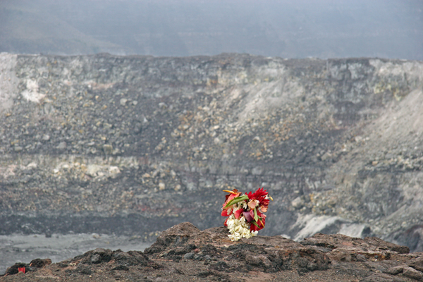
The Crater Rim Drive continues around the main crater to an overlook of Halema’uma’u crater which is thought by many to be the home of Pele, the Hawaiian Goddess of Fire. This of course makes the crater a sacred place for many Hawaiians which explains many of the offerings that are left at the edge of the crater.
Getting away from the road for a hike let us see some more of the remote areas of the park. It’s a bit of a sad story, because Volcano National Park is a bit of of an isolated refuge for many species that are under assault everywhere else on the islands due to deforestation and invasive plant and animal species that are placing pressure on native species. Pigs destroy the land and create large muddy wallows where mosquitos breed and carry avian malaria that infects native bird species. Cats, rats, and mongooses eat birds and mongooses especially hunt bird eggs placing huge pressure on native bird species. All these species are not native to the islands and some have even been brought in to try and control other invasive species. For instance, the wildly successful mongoose was brought in to control rats, but since rats are nocturnal and mongoose hunt during the day, they never see one another and simply end up competing for existing resources.
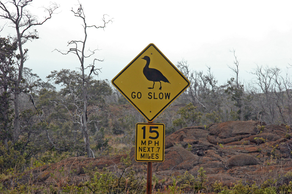
One of the things that I really, really wanted to see on this trip was a nene and Volcano National Park is one of the refuges of the nene. The nene is a ground dwelling goose and happens to be the state bird. It is a curious bird and has no real fear of humans which makes them easy prey and unfortunately all too easy to run over with cars.
Early in Hawaii’s populated history, the nene was hunted virtually to the brink of extinction for food down to the point where there were likely around a dozen wild nene living. In the late 40’s the state of Hawaii worked with a local rancher to breed them and preserve the species. There is also a flock in England that is used to supplement the gene pool from time to time. For our trip however, it turns out that the nene is the world’s rarest species of goose and there are only about 800 left in the state of Hawaii, so my chances for seeing one were not great, but I looked and I looked and I looked. Unfortunately, the closest I got to seeing a nene was this sign below.
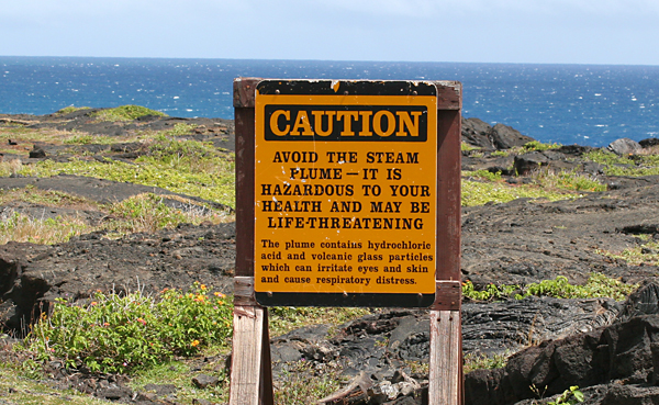
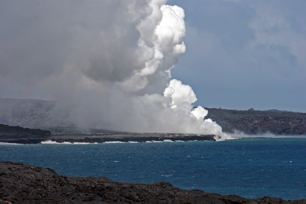
Before leaving for the day, we wanted to see where the lava was still flowing into the sea, so driving down Chain of Craters Road took us about 20 miles down to the coast to where the lava flowed over the road and into the sea during the eruption from 1992-2003. Of course again, when you start getting close to where lava flows you start seeing signs like this one reminding you once again that you are standing on a volcano.
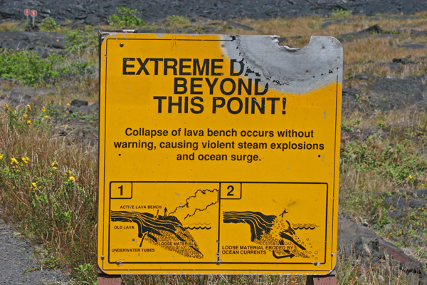
Continuing on down the road a bit more, the signs get a little more stern revealing some of the dangers that are present, and they are real dangers as people have been killed on the island due to collapsing lava benches down by the ocean. I thought this sign was particularly interesting given the melted corner and burned frame on the back side.
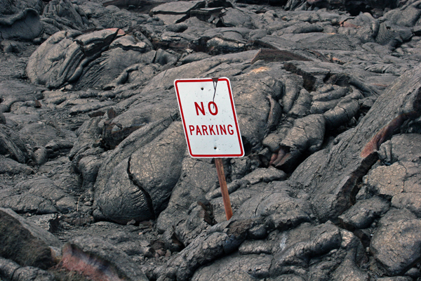
Further down and walking over lava flows along the road led to this sign that had been been covered by lava sometime after 2003.
We hiked to a decent vantage point of where the lava was flowing into the ocean making the beach around steam as sea water boils off into the air forming rising clouds that can be seen for miles around. For safety sake, we ended our hike here as it was getting later in the day and we were not prepared for an extended hike at night.
It was an amazing day hiking through country that varied from rain forest to lava fields and lava tubes to high altitude fields and grasslands. I easily could have spent a week (or two) in just this park hiking around, camping and exploring parts of Hawaii that are completely undeveloped as on the South coast, there are places where there is absolutely no development for miles around. My guess is that we will have to come back some day to hike and explore this country more, because a mere day in Volcano National Park just does not cut it.
Tomorrow is a visit to the Kona coast to visit some wonderful people at their coffee plantation, Aloha Island Coffee.